Crossing the Kaʻieʻiewaho Channel

By Dennis Chun
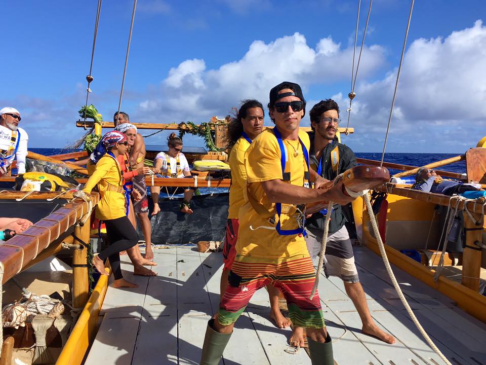
It is 3:00am on the morning of June 11th. , 2017.  A gathering of people begins to assemble along the jetty fronting the dock at which Nāmāhoe is moored.  Though it is still quite dark and the moderate trade winds have a slight chill to it, a crowd of approximately 60 people (including a crew of 19) have gathered to bid a safe journey to the crew and canoe as they prepare to cross the approximately 65 mile channel between Kauaʻi and Oʻahu.  The journey will not end with just crossing the channel, but continue on to the entrance of Keʻehi Lagoon and a final docking at the Marine Education Training Center of Honolulu Community College at Sand Island.  This will be an overall voyage that will cover nearly 110 miles.
The crowd silently assisted in the loading of personal gear of the crew, food and provisions, as well as supplies and equipment.  Nāmāhoe is planning to be away from Kauaʻi for the next two weeks as we have been invited to participate in the homecoming festivities  of Hōkūle’a as she returns from her 3 year journey around the world.  So, supplies are not limited to the voyage across the channel, but also in support of crew during the 2 weeks away from home.  Nāmāhoe is the youngest of the voyaging canoes of Hawaiʻi that has been launched since Hōkūle’a first ignited the rebirth of Polynesian voyaging in 1976.  It has just been 9 months since Nāmāhoe was launched in September of 2016 after nearly 20 years in the making.  This will mark the first time that Nāmāhoe will enter the waters of the Kaʻieʻiewaho channel, the widest channel of the main Hawaiian Islands.
Since its launching, Nāmāhoe has had the opportunity to sail only a handful of times.  A majority of the time was spent in making adjustments or modifications to the canoe, steering paddle, stanchions and railings, as well as with both the standing and running rigging.  Thus, this crossing was going to test the canoe and the modifications that were made.  Because of our lack of experience and learning from Nāmāhoe, a decision was made that until we gained more experience with Nāmāhoe, we will sail only in daylight hours and always with an escort vessel nearby.
Other factors lead to this early morning crew call and departure.  Of course, the decision to sail during daylight hours played an important role since covering the total distance needed to reach the docks at the Marine Education Training Center would take approximately 15 hours if we could average 7knots the entire way.  That would get us into the docks around 7pm.  With this in mind, Mr. Don Moses was asked to escort us and possibly tow us to Oʻahu.  As fate dictated, we were forced to have ourselves be towed the entire distance to Oʻahu since the winds shifted to a more Easterly direction that impeded our ability to sail to Oʻahu within our daylight hour restriction.  However, this was not an easy task or one which did not test the vessel or the crew.
As we slowly let off the mooring lines and slowly glided away from the dock, family members of the crew and crew members that were not on this leg of the voyage began chanting and the sound of the pū began to fill the early morning air.  This brings an eerie sense of detachment from our land base as we are then towed away from the dock and turn towards the harbor entrance and the still dark open waters of Kaʻieʻiewaho.
The sounds of the pū and chanting have long been silenced to be replaced by the rushing sounds of the ocean and wind as we move through the slowly emerging light of dawn.  The Easterly winds have picked up to a slightly brisk speed which has created a very choppy wind swell of 5 to 8 feet in height.  We are being towed directly into this as we make our way toward Oʻahu.  Nāmāhoe seems to take this abuse in stride as we seem to glide over the waves rather than punching through them.  Every so often a larger wave will strike the port side bow, but Nāmāhoe seems to shake this off with a shrug and then proceeds to glide down the backside of the wave.  The crew, at first, struggles to keep a course behind the escort vessel.  However, as time goes by, Nāmāhoe reveals her preferred style of being guided.  The crew learns of steering to correct a slight weather helm, but not to over steer.  Lessons are being learned of Nāmāhoe’s performance in spite of being towed.  The crew, divided into 3 watches or rotations, take their turn on the steering paddle, keeping a lookout on the towline, watching for sea conditions, and checking the hulls for water or anything abnormal.  In addition, as we estimate that we are near the halfway point of our journey, all eyes begin to search the horizon for signs of land.  Just off our port bow a noticeable stationary cloud bank draws our attention.  We estimate that this would be Kaʻena Point and keep tabs on this location.  By this time we estimate that it is about noon or about 8 hours since our departure and at least 3/4 of the way into the channel, so the island should be revealing itself soon.  However, with the sun being above us, it is difficult to make out any solid outlines that would make a definite identification of an island possible.  So, we continue along on our course with an eye on the cloud banks and eyes searching for more clues of land.
As the sun begins to sink behind us to the west, the cloud bank that we had been tracking reveals a darker outline of a mountain.  As we watch, more reveals itself as we make out the silhouette of Kaʻena Point and the peak of Kaʻala.  Our current course takes us south of Kaʻena on a line to Kalae, commonly called Barbers Point.  By now it is nearly 4pm as we estimate it will take us at least another 3-4 hours to reach Sand Island and the Marine Education Training Center (METC).
It is always an interesting view gliding along the coast from Kalae passing the entrance of Pearl Harbor and watching the flight patterns of aircraft overhead as they make their landing approaches to Honolulu Airport.  We are glad that we are making our own approach to Keʻehi Lagoon channel in the daylight hours.  In times past sailing Hōkūlea into Keʻehi Lagoon at night has proven to be a challenge.  With so many lights in close proximity, it was difficult to single out the channel markers, range markers, and harbor entrance tucked in with street lights, traffic lights, as well as lights from the airport and runways.  So, our approach to Sand Island and METC proved to be a straight forward approach.  Radioing ahead we made contact with Billy Richards who was standing by on VHF radio at the dock of METC.  As we made our way down the channel toward METC, on our starboard side appeared Mokuaea Island.  In passing this island and its handful of residents we blew the pū and did a short ‘oli in respect to their area.
At approximately 7:00pm we tied up to the dock of METC with the aid of Billy Richards, Mark Admundson, Mark Keala Kimura, and even a few parents of some of our crew members.  Nāmāhoe had finally arrived to the island of Oʻahu making its first channel crossing.  Leg 1 had come to a close.  The coming week was going to be one of working on Nāmāhoe and preparing her to sail with a fleet of Polynesian voyaging canoes honoring/celebrating the return of Hōkūle’a from her around the world voyage.